
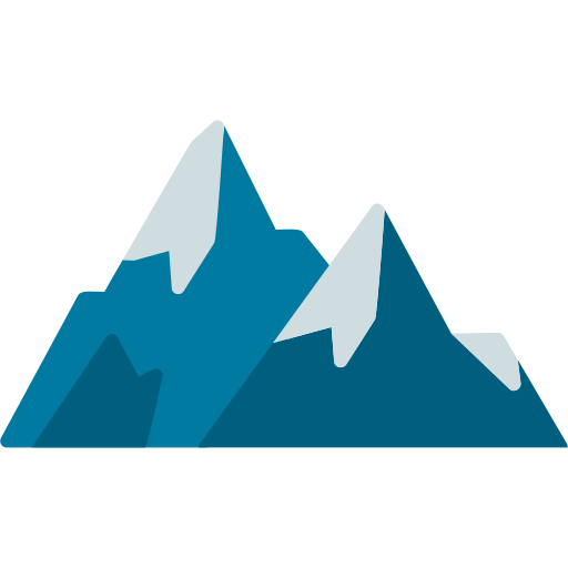
Brahmatal Trek
5999 / Per Person
Altitude :
12150 ft.

Duration:
6 Days

Trek Length
25km
Base Camp:
LohaJung

Trek Difficulty :
Easy to Mod.
Altitude :
12150 ft.
Duration:
6 Days
Trek Length
25km
Base Camp:
LohaJung
Trek Difficulty :
Easy to Mod.
Overview
The Himalayan meadows conceal Brahmatal, a heavenly lake 3444 metres above sea level. Brahmatal’s top is 3718 metres high. Lord Brahma has regarded Brahmatal his sanctuary for meditation from the beginning of time. Brahmatal verifies the shape of Brahmkamal, the primal flower in Uttarakhand’s Himalayan area. Chamoli Garhwal is home to Brahmatal. From October through March, Brahmatal Lake is entirely frozen. The paths to Brahmatal are all covered with snow. Brahmatal’s peak crown is snowcapped. Trekkers will have little trouble reaching the snow-covered top of Brahmatal. Along the hike path, you will see a variety of wildlife, including Barasingha and Himalayan foxes, White beer, Himalayan wild goat (Black & White), Ibex/Thar, and Himalayan wild goat (Black, & White), Ibex/Thar, which licks the mountain slopes to distribute medicinal juice of Shilajeet, Katukki… Monal, an effervescent bird in Uttarakhand with rainbow-colored feathers, invites you to the highlands. The Brahmatal, which is thickly forested with Deodar, Rododendron and Thuner (Taxus Baccata), Khorsu, and other plants, guarantees that there is always ample oxygen. The monsoon season is ideal for strolling through this lush-green valley. At this time of year, animals go to the plateau to feed onthe Himalayan wet grassland.
Throughout the year, every passenger feels a close connection to other notable Himalayan peaks in the enigmatic country of Brahmatal. Upper Kunji’s meadow is an excellent alternative grazing location for daring farmer travellers. Upper Kuji is a hidden gem of Himalayan tranquillity for both hikers and residents. Brahmatal, a lake hidden deep inside Brahmatal, is immersed in the mythology of the Uttarakhand Himalayas. Brahmatal is a unique Himalayan location that can only be accessible by trekking during the months of December, January, and February. This journey has a lot of pull forces. The scenery shifts from dark and brooding oak woodlands and rhododendron groves to snow-covered meadows, lakeside camping at Bekaltal, and stunning high peaks glistening against a dazzling sky. Mt. Trishul may be seen during a low-lying journey like this one since massive ice-capped summits like Mt. Nanda Ghunti are seldom seen. The steepness of the slopes is caused by the slow climb of undulating hills. Brahmatal Trekking This path is appropriate for both novice and expert hikers. The walk is mostly through forest, which lessens the danger of altitude sickness. The journey will not deprive you of an exciting winter experience. It will provide you with the wonderful mellow sound of falling snow, a magnificent route, and the solitude of the oaks and rhododendrons.
Itinerary
Day 1: Drive from Rishikesh to Lohajung
Distance: 250Kms
Time: 11-12hrs
Rishikesh is the starting point of the adventure. You will be picked up by our transport manager at the ISBT in Rishikesh at 6:15 in the morning, and from there you will be driven to Lohajung, which is the settlement that serves as the starting point for our climb. About 250 kilometres separate Lohajung, which is located in the Chamoli district of Uttarakhand, from Rishikesh, the state capital of Uttarakhand. The journey there will take you between 10 and 11 hours to complete. Trekup India can arrange for Bolero, Tata Sumo, or travller vehicles to transport passengers to Lohajung. At the time of your arrival in Lohajung, you will be assigned a room in the guesthouse. You will travel through mountain roads as you make your way from Rishikesh. If the weather is fine, you may be able to get a glimpse of the Garhwal Himalayas in the distance. The River Ganga will be there to keep you company while you take in the serene scenery. While travelling around the country, you will come upon the three most important holy confluences in the nation, which are known as Devprayag, Rudraprayag, and Karanprayag. In the vicinity of Devprayag is where the Alakananda River meets the Bhagirathi River for the first time. It is feasible to make out the different shades of teal and turquoise that are produced when two rivers meet to form a larger river. As you go through Srinagar and come across Rudraprayag, which is the location of confluence of the Mandakini River and the Alakananda River, and as you travel around 33 kilometres away from Rudraprayag, you will come across the third confluence you will experience on the route: Karanprayag The point at which the Mandakini River and the Pindar River come together. The majestic Nanda Ghunti mountain is brought into striking proximity as you go up Lohajung. If we are able to reach the summit before nightfall, you will have the opportunity to see breathtaking sunsets over the mountain’s summit, which will paint it with breathtaking hues. The origin of the name of the settlement is the subject of an interesting local legend. The villagers have a legend that the Hindu goddess Parvati fought the demon Lohasur, who gave the place its name, in a “jung,” which literally translates to “war” in Hindi. There is a small market in the town of Lohajung, and it is here that you will be able to buy camping equipment and several other necessities that will be of use to you on your adventure. Because Lohajung is a town located at the peak of the mountain, you should prepare for the climate to be brisk, especially during the evening hours. Depending on the season, there is also a chance that it may be cloudy and wet. Bring clothing that will enable you to acclimatise to the varying temperatures throughout the day.
Day2: From Lohajung to Bekaltal trek
Distance: 6Kms trek
Time: 5 hours approx
Today is the first day of the hike, and after arriving at Lohajung to catch the bus, we will immediately go to the Bekaltal campground. Following a delectable breakfast, we’ll start our journey by travelling in the direction of Bekalatal. Along the way, you’ll be treated to views of Mount Nanda Ghunti that are just stunning. After four to five hours of hiking through a coniferous forest that is mostly made up of oak and fir trees, the route arrives at the Bekalatal Campsite. Spend the night at the Bekalatal Campsite in a tent that sleeps two people at a time. The path leading to the Bekaltal campground is about six kilometres long and has a gentle ascent. The routes are well marked, and after a short stroll along the course, one will arrive in Mandoli, which is the first mountain village. Mandoli. As you continue to travel down the route, the Mandoli settlement will appear on your left. The route continues to gradually ascend as it makes its way across the various mountain ranges, winding about and bending as it goes. It is possible to visit a region that is known as the Kali Valley, which is located at the point where the Kali and Pindari Rivers meet. After finishing Mundoli, it is recommended that you take a trip through several densely forested regions that have oak, fir, and cedar trees in addition to a certain amount of rhododendron plants. The aroma of freshly cut wood is one of the most recognisable features of a forest. You can observe the blossoms of the Rhodendron flowering and bringing a blush to the lovely mountains throughout the spring and the late winter months. The path is completely hidden by snow the whole time winter is in effect. After travelling for two hours, you will come to the next site of interest, which is a wooden bridge that is around 10 metres in length and spans a creek. At this particular water supply, there is the possibility of water rationing. After making your way over the bridge, you will find yourself in Begum, a serene and picture-perfect place to take a break. The Nanda Ghunti is the most prominent skyline in the region, and tourists may enjoy beautiful views of Navali and Bagdi Bugyal as well as stunning vistas of the surrounding mountains from this particular location. The destination of Gujreni may be reached by continuing to walk for another twenty minutes; on route, you will pass by two streams in the neighbourhood. There are also some hikers who decide to stop at Gujreni, but the most of us are going to go on to Bekaltal and set up tent there. It is possible to see Himalayan bird species in Gujarati, such as the Asian Barred Owlet, Woodpeckers, Solitary Snipe, and Blue-fronted redstarts, if you go bird watching in this area. Gujarati is a good place for bird viewing. You have reached the last section of the walk for the day. Bekaltal has a sandy beach that can be reached after about an hour and a half of walking in the direction of the village. Our campground is located about fifteen minutes away from the lake. After you have set up your tents, you may take some time to relax and then go to the lake later in the day. Bekaltal Lake, so named for its stunning location in the middle of an oak grove, An enthralling experience awaits you at the end of the hike in the form of the lake’s placid waters.
The lake is situated in the middle of a thick grove of oak trees, and during the course of the year, the water in the lake retains its dark brown colour. The huge amount of organic debris that is breaking down into the oceans is the primary cause of the unique brown hue that can be seen in the lakes. The presence of organic stuff alters the colour of the water and imparts a tinge of brown to it. When the temperature drops, there is a possibility that the water may get covered in a thin coating of ice. After seeing the breathtaking sunset from Bekaltal, you should go back to your campsite to enjoy the delectable food that has been prepared for you, and then you should retire to the comfort of your camping tent to get some rest.
Day3: From Bekaltal to Brahmatal Lake trek
Distance: 7Kms
Time: 7hrs approx
Utilize the snowy pathways to your advantage as you make your way to Brahmatal. The trek is around a four-hour endeavour in duration. The path winds through the forest, and once you reach the peak of Telindi, you will be rewarded with beautiful views of the Himalayas. You will reach Brahmatal and Khabekhal Lake if you stay on this trail and travel till you get there. Tents will be provided for you to sleep in tonight.
Day4: From Brahmatal lake trek to Summit and back to Daldum camp
Distance: 12Kms
Time: 9hrs approx
Following breakfast, you will have time to get ready for the ascent to the summit of Brahmatal. Make your journey over Chota Jhandidar and Bada Jhandidar on one of the dangerous trails. This trail is surrounded on all sides by a mountain ridge and has valleys on either end. It takes about two and a half hours to get to Brahmatal Top. Take some time to appreciate the magnificent sights of the Himalayan Ranges while you’re on this trip. From Nandhaghunti, you can get breathtaking views of Mount Trishul, which is not very far away. You’ll be able to take in breathtaking panoramas of the snow-capped Himalayan Ranges once you reach the summit. Keep going until you reach the next camping spot in Daldum; the entire journey should take no more than three hours to finish. After completing this hike, you will have travelled a total distance of 2.7 kilometres. On these hiking trails, the forests will also serve as your travelling companions.
Day5: From Daldum Camp to Lohajung trek
Distance: 4Kms
Time: 5hrs approx
To get to Lohajung from Daldum, take the left fork in the road. It is a short hike of approximately 4 kilometres that will take anywhere from 3 to 4 hours to complete. The ascent to Lohajung takes a well-marked path that passes over a few streams and continues on through the oak and rhododendron covered forest that you passed through earlier. This is the same trail that you encountered for the first time. As you make your way through the forest, you will eventually come across the shepherd’s huts that the locals use to house their livestock. From this point forward, follow the road that is paved with stone. It establishes a connection between the communities in the mountains and Lohajung. After arriving in Lohajung, you will have the option of freshening up in the guesthouse and then spending the later part of the evening exploring the surrounding town. As was stated earlier, the sunsets that can be seen from Lohajung are absolutely breathtaking. This location offers a breathtaking view of the sunset. In the event that you would want to acquire mementos from the expedition, you may do so in the market in the town. The guesthouse provides guests with the most delectable lunch of the day. The following day, once you’ve had a restful sleep, we’ll get in the car and go back to Rishikesh.
Day6: From Lohajung to Rishikesh drive
Distance: 250Kms
Time: 11-12hrs
As we draw to a close on this incredible trip, we will bring you to Rishikesh today to celebrate the occasion. Following the conclusion of your last morning tea and breakfast with the crew, we will go in the direction of Rishikesh. The distance between Rishikesh and Lohajung is 210 kilometres, and it will take around 10 hours to go back. At around 7:00 o’clock in the evening, it is anticipated to arrive at Rishikesh. It is possible that the amount of time required to reach Rishikesh may change depending on the route and traffic conditions. On the way to Rishikesh, we will travel along these similar paths.
Inclusion
- 6 days premium trek
- Double sharing basis of tents through the trek.
- Dehradun to Lohajung & Return Transport in Tempo/Bolero/Sumo Vehicle
- All meals – vegetarian
- Campfire at Camps (If Available)
- Trekking permits and forest camping charges
- Trekking equipment (Tents, sleeping bags, ice axes, ropes, etc.)
- Expert trek leader (qualified in basic/advanced mountaineering courses)
- Services by Expert Team (guides, cooks, helpers)
- Safety equipments (first aid, medical kit, etc.)
- Achievement Certificate
- Memories of Life Time
Exclusion
- Pickup from your place
- Luggage carries charges
- Food during travel
- Any kind of personal expenses
Fitness
As you climb to higher altitudes, the air grows thinner and less oxygen is present. The amount of oxygen in our blood is equivalent to the proportion of haemoglobin that is saturated with oxygen. At altitudes above around 2,100 metres (7,000 feet), the amount of oxygen carried by our blood starts to decrease. At the same time, the human body possesses both immediate and long-term adaptations to altitude that help it somewhat compensate for the shortage of oxygen.
A Great First Trek for Anyone Who Wants to Get Into Hiking:
- The Brahmatal Trek is an Easy to Moderate level trek in terms of fitness requirements. The track is well-marked and has only modest inclines and declines. Water fountains may be seen at various points throughout the path. However, it’s still best to be ready if you’re planning your first major Himalayan trekking adventure. Here is a plan for getting in shape for the trip.
- Our hikes are typically designed such that you cover around 9 kilometres in six hours, however this might vary somewhat depending on the terrain. It’s about the same as walking 6 kilometres an hour over the plains, therefore the speed is around 1.5 kilometres per hour.
- Following this plan, you may train yourself to run 3 kilometres in 30 minutes. Always begin your workout routine with some light stretching and warm-up moves.
- Follow this training schedule for trekking fitness required:
- Week 1: Walk for 10 minutes at a fast pace, jog for 10, and finish with a slow stroll for 10 minutes.
- Week 2: 15 minutes of jogging, followed by a 5-minute brisk walk. A leisurely stroll that takes no more than 5 minutes
- Week 3: Walk briskly for five minutes. Jogging for 15 minutes A brisk stroll that takes no more than 5 minutes
- Week 4: Do a brisk 5-minute walk, then a 25-minute jog, and finish with a 5-minute cool down.
Safety
Points to remember for safety in the trek:
- It is essential that you arrive at the starting point of any hike or excursion in the best possible physical condition and readiness.
- The hike is not tough; in fact, if you can keep both your feet and your mind calm and strong during the journey, you will discover that the hike is rather simple.
- When you are out on a hike, bear in mind that you may not always be with your guide and that you may not always be on the correct trail.
- The majority of individuals glance both where they are going and where they are going while they are walking; this might produce twitching in your legs, which can make the whole journey difficult.
- It is imperative that you see your physician if you are experiencing any kind of health issue.
- It is imperative that I have my medical equipment with me at all times; it is of the utmost significance.
- Indiantreks will ensure that you have a fully stocked first aid kit at all times, including oxygen cylinders and other medications that may be required throughout the trek.
- In the event that any of the trekkers have any more difficulties, the stretcher is used to transport them back to the base camp.
- During the Brahmatal Trek walk, our camp is situated close to the tree line, so you won’t have any trouble getting enough oxygen there.
- In the event of a medical emergency, you should seek the assistance of your guide or another trekker who is knowledgeable in the area.
How To Reach
Directions to go to Rishikesh:
- By Air: Jolly Grant Airport is the domestic airport that serves Dehradun, and it receives frequent flights from the main metropolises located across India. From Dehradun, you can take a taxi or bus to Rishikesh for 1-2 hours approx drive.
- Traveling by Train: The Dehradun junction is the closest railway station, and it has excellent connections to major cities located around India. From Dehradun, you can take a taxi or bus to Rishikesh for 1-2 hours approx drive.
- By Road: The road network in and around Rishikesh is extensive and convenient. To get to Rishikesh from Delhi or any of the other surrounding cities, you have the option of either driving there yourself or hiring a cab or taxi. In addition, there is a consistent bus service between Dehradun and the surrounding areas because to the extensive road network.
Thing To Carry
Directions to go to Rishikesh:
- By Air: Jolly Grant Airport is the domestic airport that serves Dehradun, and it receives frequent flights from the main metropolises located across India. From Dehradun, you can take a taxi or bus to Rishikesh for 1-2 hours approx drive.
- Traveling by Train: The Dehradun junction is the closest railway station, and it has excellent connections to major cities located around India. From Dehradun, you can take a taxi or bus to Rishikesh for 1-2 hours approx drive.
- By Road: The road network in and around Rishikesh is extensive and convenient. To get to Rishikesh from Delhi or any of the other surrounding cities, you have the option of either driving there yourself or hiring a cab or taxi. In addition, there is a consistent bus service between Dehradun and the surrounding areas because to the extensive road network.
Must Read Articles
Best time for the trek
🗓️ Best Time to Trek — A Guide by Octatrav
One of the key advantages of many Himalayan treks is that they remain accessible for a large part of the year. Most trekking routes open up in March, welcoming trekkers with springtime freshness and moderate temperatures. This season continues through late June, offering pleasant weather and clear views—ideal for a memorable trekking experience.
🍁 Trekking resumes in mid-September and continues until late November, when the landscape transforms with golden leaves and crisp air. This autumn window is perfect for those who prefer scenic beauty combined with clear skies.
❄️ Winter trekking, although breathtaking, comes with challenges. From December to mid-March, most high-altitude trails get buried under heavy snow, making them inaccessible or risky. Government authorities usually restrict entry during this time to avoid mishaps due to extreme cold, snowfall, and avalanches.
✅ Summary:
Spring & Summer (March–June): Best time for pleasant weather and blooming landscapes.
Monsoon (July–Early September): Most trails are closed due to safety concerns.
Autumn (Mid-September–November): Ideal time with great weather and views.
Winter (December–Mid-March): High snow levels; many treks remain closed.
With Octatrav, you’ll always be informed about the best seasons for your chosen trek. Our expert guidance ensures that you trek during the safest and most scenic times of the year, making your adventure both memorable and secure.
How Difficult is the trek
This trek is generally considered to be of moderate difficulty, with a rating that can vary from easy to challenging depending on your experience and fitness level.
The journey begins at a base village situated around 6,000 ft, gradually ascending to a maximum altitude of nearly 11,500 ft over the course of a few days.
While the route mostly involves a pleasant hike through scenic landscapes, here are two main reasons why it falls under the moderate category:
– Long daily distances: On average, you may be covering 10 km per day, which demands good stamina and consistent pacing.
– Limited exit points: Most treks of this nature have only one route in and out, making emergency exits or quick returns difficult in case of unforeseen situations.
How to get fit for your trek
How to Prepare for a High-Altitude Trek
Fitness Guide by Octatrav
Preparing for a trek requires building both stamina and strength. One of the best ways to get started is by jogging, which targets the same muscles used during trekking—calves, glutes, and hamstrings. It’s a simple and effective way to improve endurance without the need for any equipment.
Minimum Fitness Target
To trek comfortably, you should be able to run 5 km in under 60 minutes. This ensures that you can maintain a steady pace and handle long walking hours at altitude.
How to Achieve This?
Here’s a structured plan you can follow:
🏃♂️ Cardio Training:
Jog at least 4 times a week – consistency is key.
Start small – begin with 2 km runs and gradually increase the distance.
Pace improvement – once you’re running 5 km, aim to bring your timing down to under 35 minutes.
Maintain for 2 weeks – consistently hitting this goal helps build real endurance.
⏳ Training Duration:
Prepare for at least 4–6 weeks based on your current fitness level. The earlier you begin, the better your trek experience will be.
💪 Strength Training Routine
Combine cardio with strength workouts to build muscular endurance:
Squats – builds quads, glutes, and hamstrings.
Lunges – mimics trekking motion; strengthens the entire lower body.
Step-ups – improves climbing strength for steep trails.
Core exercises – planks, Russian twists, leg raises for balance and stability.
Back workouts – deadlifts, bent-over rows, and shoulder presses to carry your backpack with ease.
🧘♂️ Flexibility & Recovery
Stretch daily – especially your calves, hamstrings, quads, and lower back.
Incorporate yoga or Pilates – enhances flexibility and mental focus.
Take rest days – they are essential for muscle recovery and injury prevention.
🔁 Trek-Ready Summary
🏃♂️ Cardio: Build stamina through jogging.
💪 Strength: Focus on legs, back, and core.
🤸♂️ Flexibility: Stretch regularly and stay injury-free.
⏳ Consistency: Stick to a 6–8 week routine for best results.
10 Reasons to Choose Octatrav for Trek
Why Choose Octatrav for Your Trekking Adventure?
Trekking in the Himalayas is a thrilling and unforgettable experience. Whether you’re walking through snow-covered paths, lush forests, or peaceful riversides, choosing the right trekking operator is crucial for a safe and comfortable journey.
Octatrav stands out as a trusted name in the trekking world. Here are 10 strong reasons to choose Octatrav for your next high-altitude adventure:
1. Experienced Professionals
Octatrav’s team includes highly trained professionals who know the terrain, weather, and routes in depth. Their insights and support will elevate your trekking experience.
2. Focused on Safety
Trekking at altitude can be unpredictable. Octatrav ensures your safety by equipping the team with first-aid kits, oxygen, and emergency protocols for any situation.
3. Small Group Sizes
To give you personal attention and a relaxed experience, Octatrav keeps group sizes small. This also reduces environmental impact and makes for smoother trekking.
4. Eco-Friendly Trekking
Octatrav encourages responsible travel. From minimizing plastic use to proper waste disposal at campsites, they help you leave no trace.
5. Comfortable Camping
After a long day of trekking, good rest matters. Octatrav sets up cozy camps with quality tents, warm sleeping bags, and hot meals so you sleep well and stay energized.
6. Nutritious Meals
Fueling your body right is essential. Octatrav serves fresh, nutritious meals for both vegetarians and non-vegetarians to keep your energy levels high throughout the trek.
7. Affordable Packages
You don’t have to overspend for a great experience. Octatrav offers budget-friendly packages that include accommodation, meals, guidance, and permits—everything you need.
8. Relaxed & Scenic Pace
Octatrav designs treks that balance exploration and rest. You’ll get ample time to absorb the beauty around you without rushing through the journey.
9. Customizable Itineraries
Want a special experience? Octatrav helps you tailor the trek to your preference—be it a solo hike, photography-focused trail, or a slower pace.
10. Trusted by Trekkers
Octatrav is praised by many happy trekkers for its hospitality, safety, and professionalism. The positive reviews speak for themselves.
Why You Should Do the Har Ki Dun Trek
Why Choose This Himalayan Trek for Your Next Adventure? – by Octatrav
Exploring the Himalayas is a dream for many, and every trail has its own magic. Whether you’re a first-time trekker or a seasoned explorer, here are ten reasons why your next trek with Octatrav can be an unforgettable experience:
1. 🏔️ Breathtaking Scenery
Enjoy mesmerizing views of snow-covered peaks, lush green valleys, sparkling rivers, and alpine forests. Each turn on the trail feels like walking through a postcard.
2. 🏡 Rich Cultural Experience
Pass through remote villages where you can interact with warm-hearted locals, witness age-old traditions, and taste authentic mountain hospitality.
3. 🌿 Diverse Flora and Fauna
From rare Himalayan birds to elusive animals like musk deer or black bears, the region is rich in biodiversity. Nature lovers and wildlife photographers will find every step rewarding.
4. 🥾 Moderate Difficulty Level
Most Himalayan treks are rated as moderate, which makes them suitable for beginners with preparation, and still exciting for experienced trekkers looking for beauty and challenge.
5. 📖 Mythological & Historical Depth
Many Himalayan regions are steeped in legend and ancient lore. Walking these trails often feels like stepping into a living story from Indian epics or ancient folklore.
6. 🤫 Peaceful & Untouched
Less commercialized treks offer serene trails where you can disconnect from city chaos and truly reconnect with nature and yourself.
7. ⛺ Unique Campsites
Camp under a sky full of stars, beside rivers or deep in pine forests. The silence, the chill, the camaraderie — it’s an experience that stays with you forever.
8. 🎒 Adventure Add-ons
Beyond trekking, enjoy photography, bird watching, star-gazing, or even meditative moments in nature. It’s not just a trek — it’s a full adventure retreat.
9. 🌅 Magical Sunrises & Sunsets
Witness golden hours like never before — with Himalayan peaks glowing pink, orange, and gold. These views are pure magic and make every effort worthwhile.
10. 💪 Personal Growth
Trekking challenges your body and mind, pushing you beyond limits. By the end, you’ll not only have beautiful memories but also a stronger, more confident version of yourself.